This run is longer than the one above, slightly less difficult and contains two very high gradient sections as well as a very long and difficult possible portage around the difficult waterfall and gorge below the Park Headquarters at Ash Mountain. Between the major major drops there is a surprising amount of the river that can be run by boat scouting or easy scouting from the bank. Everything is easily portable with the exception of the Gorge. High above on the right the road is never far away but the bank is steep and there is mega poison oak. This section is also sometimes refered to as The Hospital Rock Section by those who don't descriminate between the two sections. Very seldom is this run attempted in combination with the real Hospital Rock Section due to the high overhead and long day that results.
RM 4.4 Put-In below where the Marble Fork siphon and suspension bridge crosses the river
The put-in is 100yards down an easy trail that takes off from the RV dump station opposite Potwisha Campground
RM 4.2 Confluence with the Marble Fork
RM 4.0 Gradient Picks Up
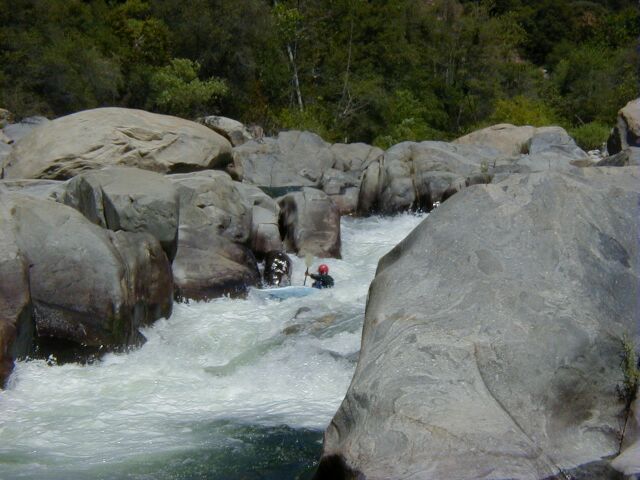
Numerous Class 5 drops in the next 0.3 miles. Scouting is possible on the way to the put-in from a trail off a highway turnout. The Giant Sluice, is one of the bigger drops in this section.
RM 3.0 Gradient picks up
Another big drop is located in this section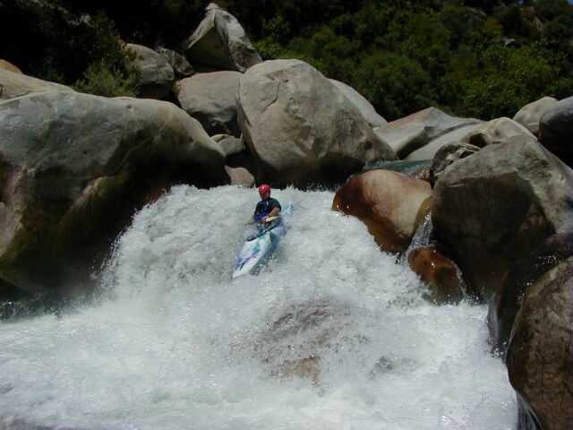
RM 2.2 Gradient picks up
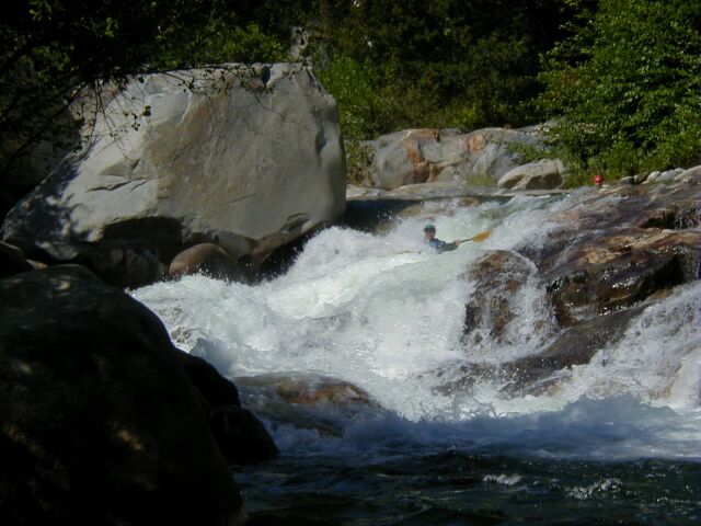
A couple more big drops are located in this section, A Boulder Squeeze and A High Speed Slide into a surging whirlpool on the right wall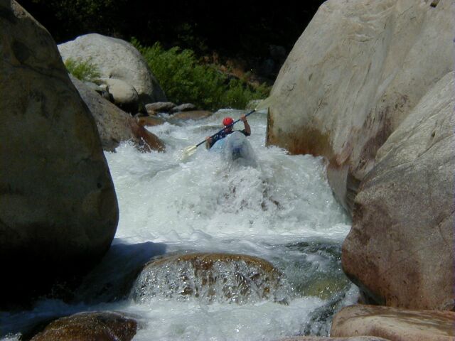
RM 1.7
The river drops at 240 ft/mile for the next 0.6 miles as it winds around the Ash Mountain Park Headquarters. There are Numerous Class 5 Drops in this section. There is a trail to the river from the Park Headquarters. If the last quarter mile seemed a bit much, then the trail might be the best option. This is also a possible take out point, avoiding the portage entirely.
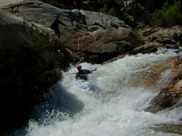
RM 1.1 POSSIBLE PORTAGE, Class 5+ Entrance Rapid
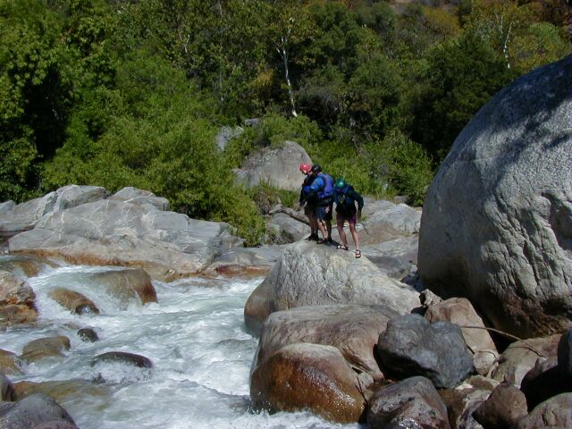
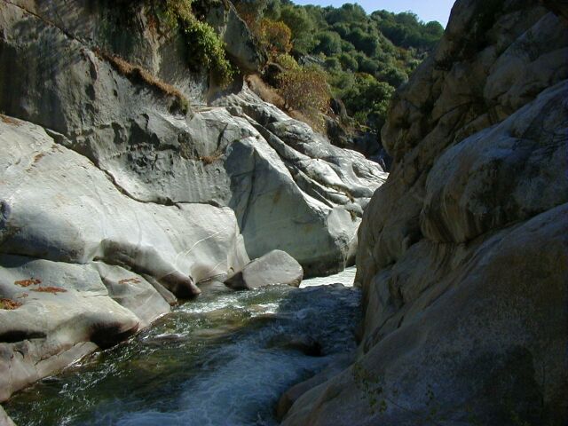
into a Shear Gorge followed in 25 yards by a 10 foot waterfall into the heart of the gorge. The best portage is to take out 300 yards upstream at the trail to Ash Mtn. Park Headquarters, hike to the road and portage down the highway 300 yards then take the easy swimmers trail back to the river at a turnout 50 yards downstream of the Southern Sequoia Research Center driveway. The Strenuous Portage up the cliffs just before the gorge is not recommended. Be careful in the section before the gorge. Boat too far and your only exit may be up the cliffs if you elect not to run the Class 5+ into the gorge. It is reported that you will go deep in the Falls. The river looses 30 feet in the entrance rapid and the falls in a 75yard stretch. Most of the drop is in the entrance rapid going into the gorge. Scout the waterfall into the gorge from the swimmers trail before your run if you are unfamiliar with the gorge. You can see the left half of the falls easily and the entrance rapid with a bit more work.
More difficult drops continue below the still and deep waters of the gorge.
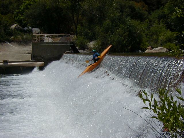
RM 0.5 Take out above the Diversion Dam
or boat the next rapid or two of the Park Boundary run. If you run the Diversion Dam, do so at a point 40% to 50% of the way across from the left bank. There is rebar stubs protruding vertically from the concreate in the first ledge closer to the left bank. Further right is an option also.130 cfs leaves the river at the Diversion Dam
RM 0 Confluence with the East Fork
This used to be a takeout/putin but it is now closed. You can continue down the Middle Fork to a more legal takeoutLook upstream Hospital Rock to Confuence with Marble Fork
Continue downstream Park Boundary to Confluence with the East Fork

Copyright © 1996, 1997, 2000 by Bill Pooley. All rights reserved.
This page is http://www.c2.com/kaweah/log_ashmountain.html
Last modified: 07.02.00 following a run of this section 6-25-00 at 300cfs (4.60ft on the SCE Middle Fork Gauge)